the wicklow way
PLAN YOUR NEXT ADVENTURE!
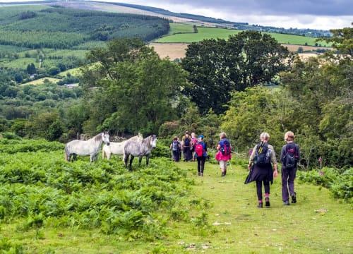
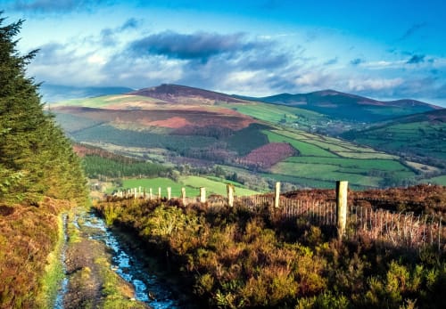
“The Wicklow Way” is Ireland’s first waymarked trail, and due to its proximity to Dublin has remained one of the most popular walking routes in Ireland. Tinahely lies directly on this magnificent trail, and provides the perfect base for exploring one of Ireland’s best-loved and most authentic paths. Tinahely is the perfect starting point, and the Way can be followed all the way from here to Dublin, allowing a dramatic encounter of the wilds of Leinster sweeping into the genteel suburbs and city life.
The southern region of the Way, around Tinahely itself, boasts fantastic rural scenery and pleasant resting sites, and here the climbs are gentler as it winds its way along forestry roads through a landscape of conifer-covered foothills. Terrain consists of forestry tracks, quiet roads, boreens and mountain paths through open moorland. Some sections can be wet and muddy. The total ascent over the entire route is about 2820 m.
Click here to view the detailed Wicklow Way Map.
See WicklowWay.com for more information.
Wicklow Way Walk to Tinahely
What is the Wicklow Way?
The Wicklow Way is a renowned long-distance hiking trail located in County Wicklow, Ireland. Stretching over 130 kilometers (80 miles), it traverses through some of the most picturesque landscapes in the country, offering hikers a chance to immerse themselves in the natural beauty of the Wicklow Mountains and surrounding areas. Here's some information about the Wicklow Way:
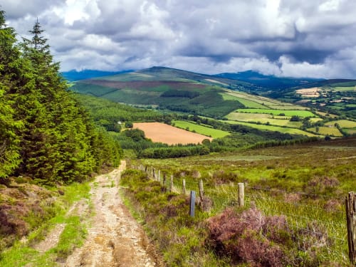
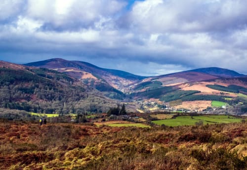
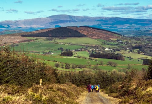
1. Scenic Route: The Wicklow Way takes hikers on a journey through diverse and captivating scenery. The trail winds its way through rolling hills, lush forests, serene lakes, and panoramic mountain vistas, providing breathtaking views at every turn. It showcases the enchanting beauty of County Wicklow, often referred to as the "Garden of Ireland."
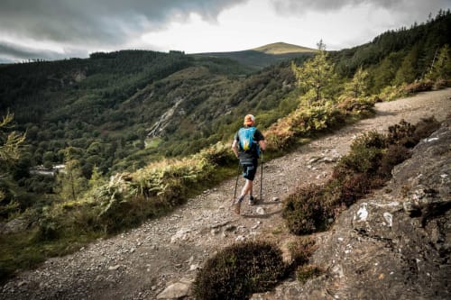
2. Trail Difficulty: The Wicklow Way is considered a moderate hiking trail, making it suitable for a wide range of hikers. The route includes both flat and hilly sections, with some challenging ascents and descents in the mountainous areas. It is advisable to have a reasonable level of fitness and some hiking experience before undertaking the entire trail.
3. Trail Sections: The Wicklow Way is typically divided into several sections, allowing hikers to tackle the trail in manageable portions. These sections range from 10 to 20 kilometers (6 to 12 miles) in length and can be completed individually or as part of a multi-day hiking adventure.
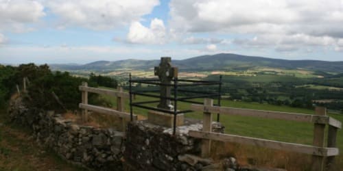
4. Highlights Along the Way: The Wicklow Way passes through several notable landmarks and points of interest. These include the stunning Glendalough Valley with its ancient monastic site, the picturesque village of Enniskerry, the iconic Powerscourt Waterfall, and the dramatic landscapes of the Wicklow Mountains National Park. The trail also offers opportunities for wildlife spotting, with chances to encounter native flora and fauna along the route.
6. Duration and Planning: The time required to complete the Wicklow Way varies depending on individual fitness levels and the pace of hiking. Some hikers choose to complete the entire trail in around 7 to 10 days, while others prefer to explore specific sections over a shorter period. It is important to plan and prepare adequately, including carrying appropriate gear, maps, and provisions.
The Wicklow Way offers hikers a captivating adventure through some of Ireland's most scenic landscapes. With its natural beauty, varied terrain, and rich history, the trail provides an unforgettable experience for outdoor enthusiasts seeking to immerse themselves in the beauty of County Wicklow.
LOCAL WALKS
Mangan's Loop Walk
Part of a group of three walks overlooking the pretty village of Tinahely the Mangan's Loop is the shorter of the three. The route starts in the village and is a loop so will bring you back to the start point. You’ll trek through a variety of terrain from quiet country lanes to forests to open mountain.
Starting at Kilcommon Carpark and making its way to the top of Mangans Lane and following green arrows, this walk climbs fairly steeply over Garryhoe Hill, crosses open ground and descends to Mangans Lane. Good views of the surrounding countryside and Mountains and of Tinahely, especially from the higher slopes.
Grade: Moderate
Markings: The route is marked with Green arrows, then Blue & Purple on the descent – Loop Trail
Distance: 12.1km
Estimated time: 3.5hrs
Total height climbed: 330m
Highest point: 390m
Terrain underfoot: Forest trail, mountain trails and country lanes.
Suitable for: Suitable for reasonably fit walkers
Notes: Parts of the route are on exposed mountain; full mountain equipment required.
How to get to Start Point: Carpark at Kilcommon Bridge
GPS TO START POINT: 52.790611,-6.45555138
GRID REF: T 04229 72155
Kyle Loop Walk
Part of a group of three walks overlooking the pretty village of Tinahely the Kyle Loop is the longest and toughest walk but the rewards are plentiful. The route starts in the village and is a loop so will bring you back to the start point. You’ll trek through a variety of terrain from quiet country lanes to forests to open mountain.
Starting at Kilcommon Bridge, climbing Mangans Lane and following purple arrows, this walk works its way around the lower slopes of Garryhoe and Ballycumber Hill as far as Kyle and then climbs over the Hill to return to Mangans Lane. Good views of the surrounding countryside, mountains and of Tinahely, especially from the top of the Hill.
Grade: Strenuous
Markings: The route is marked with Purple arrows – Loop Trail
Distance: 20.7km
Estimated time: 6hrs
Total height climbed: 535m
Highest point: 420m
Terrain underfoot: Forest trail, mountain trails and country lanes.
Suitable for: Suitable for fit, experienced walkers
Notes: Parts of the route are on exposed mountain; full mountain equipment required.
How to get to start point: Carpark at Kilcommon Bridge
GPS START POINT: 52.790611,-6.4555138
GRID REF: T 04229 72155

Ballycumber Loop Walk
Starting at Kilcommon Carpark and making its way to the top of Mangans Lane and following blue arrows, this walk works its way around the lower slopes of Garryhoe as far as a ford over a river and road. It then climbs steeply to pass between Ballycumber Hill and Garryhoe to return to Mangans Lane. Good views of the surrounding countryside and Mountains and of Tinahely, especially from the higher slopes.
Grade: Strenuous
Markings: The route is marked with Blue arrows, then Green & Purple on the descent – Loop Trail
Distance: 15.6km
Estimated time: 4.5hrs
Total height climbed: 480m
Highest point: 370m
Terrain underfoot: Forest trail, mountain trails and country lanes.
Suitable for: Suitable for reasonably fit walkers
Notes: Parts of the route are on exposed mountain; full mountain equipment required.
How to get to Start Point: Carpark at Kilcommon Bridge
GPS TO START POINT: 52.790611,-6.4555138
GRID REF: T 04229 72155
LOCAL WALKS
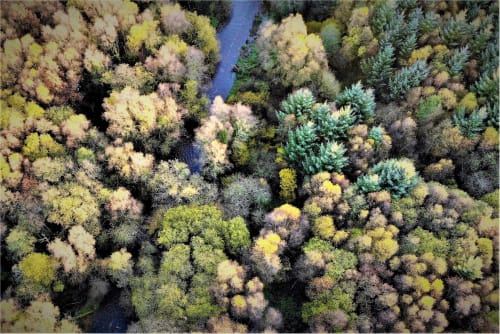
Tomnafinnoge Woods
Almost equal distant between the villages of Shillelagh and Tinahely, Tomnafinoge Wood is a Special Area of Conservation. This ancient woodland will bring you back in time. Giant Oak trees dominate but you will encounter plenty more trees and plants on these walks. Tomnafinnoge Woods offer four different walks of varying distance. Most popular is the River Walk of 2km (4km both ways) and the Beech Walk. Shorter walks are the Oak Walk, 3.2km, and the Hazel walk, only 1.3km.
Hazel Walk
Almost equal distant between the villages of Shillelagh and Tinahely, Tomnafinoge Wood is a Special Area of Conservation. This ancient woodland will bring you back in time. Giant Oak trees dominate but you will encounter plenty more trees and plants on these walks.
Grade: Easy
Markings: Red arrow on brown background – Loop Walk
Distance: 1.5km
Estimated Time: 30mins
Total Height Climbed: 25m
Suitable for: Young Families etc
How to get to the start point: Car Park at Tomnafinnogue, Tinahely
GPS START POINT: 52.777636,-6.4876829
GRID REF: T 02090 70665
Railway Walk
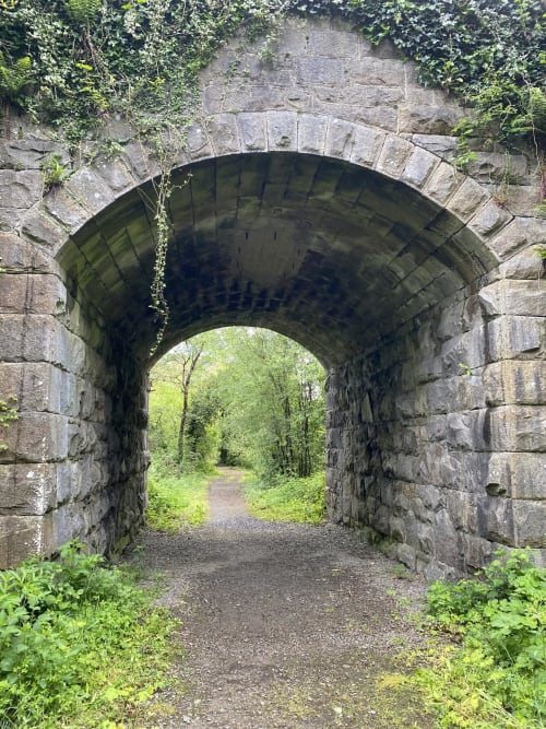
The Old Railway Walk traverses a section of the Woodenbridge to Shillelagh Railway Line which was closed in 1964. In 1965, the land ownership was transferred back to the original landowners and gradually this isolated corridor of land was colonised by the adjacent hedgerow species and became closed off from the outside world. In 2005, with the permission of the landowners, a trail was developed along a section of the track from Kilcommon to Greenhall Bridge by the Tinahely Area Development Association in co-operation with other local partners.
This peaceful linear woodland trail can be enjoyed by all the family and offers wonderful views out into the surrounding fields and farmland of Tinahely. Two magnificent stone railway bridges mark the start and finish points, providing an appropriate introduction walk. The trail itself is rich with an abundance of flora and fauna and a large section is categorised as a Special Area of Conservation (SAC). The walk crosses the Derry River over a wooden footbridge not far from KIlcommon Bridge and follows its course to the famous oak woods at Tomnafinnogue.
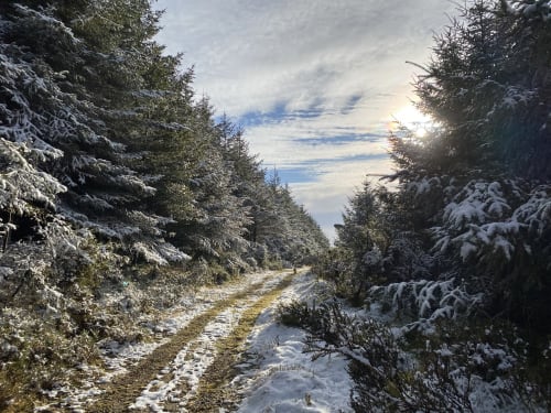
Each season offers a unique walking experience; from rich carpets of bluebell in spring to lush green summer vegetation, ripe with blackberry and crab apple and sloe in autumn in stark contrast to the bare silhouettes of winter. This trail provides a safe, off road access route to Tomnafinnogue.
Grade: Easy
Markings: None – Linear Trail
Distance: 2.9km
Estimated Time: 30mins
Total Height Climed: 0m
How to get to Start Point: Car park at Kilcommon Bridge
GPS TO START POINT: 52.790611,-6.4555138
GRID REF: T 04229 72155